
Thank you for supporting this site ❤️
Make a donation
Make a donation
Sugarcreek Township topographic map
Click on the map to display elevation.
Thank you for supporting this site ❤️
Make a donation
Make a donation
About this map
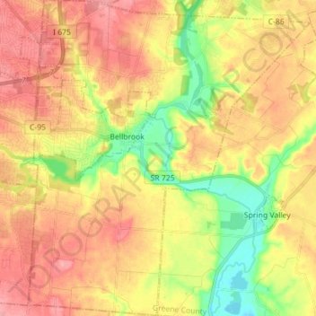
Name: Sugarcreek Township topographic map, elevation, terrain.
Location: Sugarcreek Township, Greene County, Ohio, United States (39.57441 -84.11418 39.68257 -83.98828)
Average elevation: 273 m
Minimum elevation: 221 m
Maximum elevation: 314 m
Thank you for supporting this site ❤️
Make a donation
Make a donation
Other topographic maps
Click on a map to view its topography, its elevation and its terrain.
John Bryan State Park
United States > Ohio > Greene County > Yellow Springs > Clifton
Average elevation: 309 m
Thank you for supporting this site ❤️
Make a donation
Make a donation