Geolocate

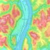
Piney Fork topographic map

Click on the map to display elevation.

About this map

Name: Piney Fork topographic map, elevation, terrain.

Location: Piney Fork, Smithfield Township, Jefferson County, Ohio, 43941, United States (40.23479 -80.84703 40.27479 -80.80703)

Average elevation: 336 m

Minimum elevation: 257 m

Maximum elevation: 391 m

Other topographic maps

Click on a map to view its topography, its elevation and its terrain.

Steubenville

United States > Ohio > Jefferson County

Average elevation: 294 m

Bergholz

United States > Ohio > Jefferson County

Average elevation: 308 m

Brilliant

United States > Ohio > Jefferson County > Brilliant

Average elevation: 261 m

Steubenville

United States > Ohio > Jefferson County

Average elevation: 294 m

Toronto

United States > Ohio > Jefferson County

Average elevation: 277 m