
Thank you for supporting this site ❤️
Make a donation
Make a donation
Bato topographic map
Click on the map to display elevation.
Thank you for supporting this site ❤️
Make a donation
Make a donation
About this map
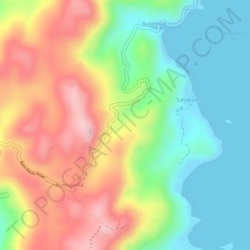
Name: Bato topographic map, elevation, terrain.
Location: Bato, Catanduanes, Bicol Region, 4801, Philippines (13.62634 124.33455 13.63455 124.34648)
Average elevation: 98 m
Minimum elevation: -1 m
Maximum elevation: 219 m
Thank you for supporting this site ❤️
Make a donation
Make a donation