
Trujillo topographic map
Interactive map
Click on the map to display elevation.
About this map
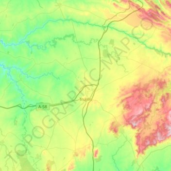
Name: Trujillo topographic map, elevation, terrain.
Location: Trujillo, Cáceres, Extremadura, 10200, Spanien (39.32240 -6.30515 39.66723 -5.73075)
Average elevation: 475 m
Minimum elevation: 241 m
Maximum elevation: 1,013 m
Die Kleinstadt Trujillo liegt ca. 1 km westlich der Autovía A-5 (auch E 90) in einer Höhe von ca. 564 m. Nächstgelegene Großstadt ist die ca. 46 km (Fahrtstrecke) westlich gelegene Provinzhauptstadt Cáceres. Das Klima im Winter ist rau, im Sommer dagegen trocken und warm; Regen (ca. 500 mm/Jahr) fällt überwiegend im Winterhalbjahr.