
美姑县 topographic map
Interactive map
Click on the map to display elevation.
About this map
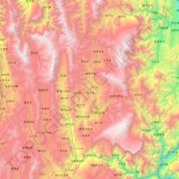
Name: 美姑县 topographic map, elevation, terrain.
Location: 美姑县, Prefectura autónoma yi de Liangshan, Sichuan, China (28.03105 102.87173 28.83269 103.33598)
Average elevation: 2,389 m
Minimum elevation: 396 m
Maximum elevation: 4,007 m
Other topographic maps
Click on a map to view its topography, its elevation and its terrain.