
Thank you for supporting this site ❤️
Make a donation
Make a donation
Kagugu topographic map
Click on the map to display elevation.
Thank you for supporting this site ❤️
Make a donation
Make a donation
About this map
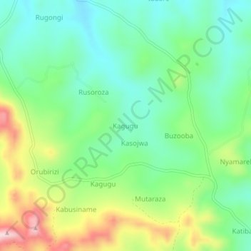
Name: Kagugu topographic map, elevation, terrain.
Location: Kagugu, Ntungamo, Western Region, Uganda (-0.97000 30.14667 -0.93000 30.18667)
Average elevation: 1,491 m
Minimum elevation: 1,390 m
Maximum elevation: 1,690 m
Thank you for supporting this site ❤️
Make a donation
Make a donation