
Thank you for supporting this site ❤️
Make a donation
Make a donation
Norra Rådom topographic map
Click on the map to display elevation.
Thank you for supporting this site ❤️
Make a donation
Make a donation
About this map
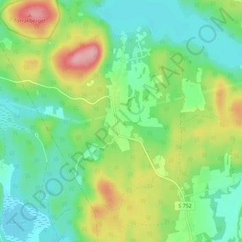
Name: Norra Rådom topographic map, elevation, terrain.
Location: Norra Rådom, Karlstads kommun, Värmland County, Sweden (59.61010 13.61370 59.65010 13.65370)
Average elevation: 111 m
Minimum elevation: 67 m
Maximum elevation: 200 m
Thank you for supporting this site ❤️
Make a donation
Make a donation