
Calheta topographic map
Interactive map
Click on the map to display elevation.
About this map
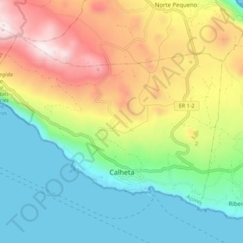
Name: Calheta topographic map, elevation, terrain.
Location: Calheta, São Jorge, Azoren, Portugal (38.59670 -28.06413 38.63926 -27.98696)
Average elevation: 339 m
Minimum elevation: 0 m
Maximum elevation: 902 m