
Thank you for supporting this site ❤️
Make a donation
Make a donation
Neuville topographic map
Click on the map to display elevation.
Thank you for supporting this site ❤️
Make a donation
Make a donation
About this map
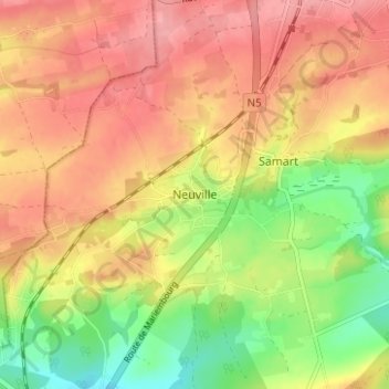
Name: Neuville topographic map, elevation, terrain.
Location: Neuville, Philippeville, Namur, Wallonie, 5600, Belgique (50.15448 4.50058 50.19448 4.54058)
Average elevation: 245 m
Minimum elevation: 188 m
Maximum elevation: 288 m
Thank you for supporting this site ❤️
Make a donation
Make a donation
Other topographic maps
Click on a map to view its topography, its elevation and its terrain.