
Ritchie County topographic map
Interactive map
Click on the map to display elevation.
About this map
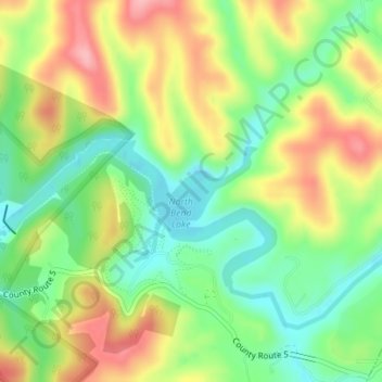
Name: Ritchie County topographic map, elevation, terrain.
Average elevation: 266 m
Minimum elevation: 209 m
Maximum elevation: 338 m
Other topographic maps
Click on a map to view its topography, its elevation and its terrain.
Sector
Estados Unidos de América > Virginia Occidental > Hampshire County
Sector, Hampshire County, Virginia Occidental, Estados Unidos de América
Average elevation: 337 m
Newhall
Estados Unidos de América > Virginia Occidental > Newhall
Newhall, McDowell County, Virginia Occidental, 24866, Estados Unidos de América
Average elevation: 623 m
Onoto
Estados Unidos de América > Virginia Occidental > Onoto
Onoto, Pocahontas County, Virginia Occidental, Estados Unidos de América
Average elevation: 800 m