
Spittelmatthof topographic map
Interactive map
Click on the map to display elevation.
About this map
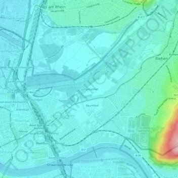
Name: Spittelmatthof topographic map, elevation, terrain.
Location: Spittelmatthof, Riehen, Bâle-Ville, 4125, Suisse (47.55480 7.60384 47.59480 7.64384)
Average elevation: 271 m
Minimum elevation: 245 m
Maximum elevation: 441 m