
Thank you for supporting this site ❤️
Make a donation
Make a donation
Sellersburg topographic map
Click on the map to display elevation.
Thank you for supporting this site ❤️
Make a donation
Make a donation
About this map
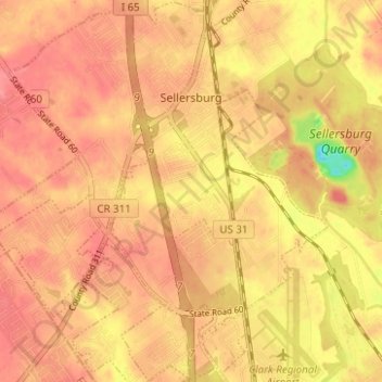
Name: Sellersburg topographic map, elevation, terrain.
Location: Sellersburg, Clark County, Indiana, 47172, United States (38.36166 -85.79063 38.41041 -85.73276)
Average elevation: 149 m
Minimum elevation: 98 m
Maximum elevation: 167 m
Thank you for supporting this site ❤️
Make a donation
Make a donation
Other topographic maps
Click on a map to view its topography, its elevation and its terrain.