
Thank you for supporting this site ❤️
Make a donation
Make a donation
Evington topographic map
Click on the map to display elevation.
Thank you for supporting this site ❤️
Make a donation
Make a donation
About this map
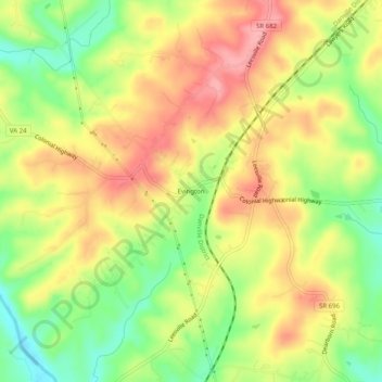
Name: Evington topographic map, elevation, terrain.
Location: Evington, Campbell County, Virginia, 24550, United States (37.21376 -79.30947 37.25376 -79.26947)
Average elevation: 222 m
Minimum elevation: 166 m
Maximum elevation: 271 m
Thank you for supporting this site ❤️
Make a donation
Make a donation
Other topographic maps
Click on a map to view its topography, its elevation and its terrain.