
Thank you for supporting this site ❤️
Make a donation
Make a donation
Bukit Melati topographic map
Click on the map to display elevation.
Thank you for supporting this site ❤️
Make a donation
Make a donation
About this map
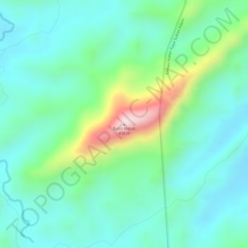
Name: Bukit Melati topographic map, elevation, terrain.
Location: Bukit Melati, Banjar, South Kalimantan, Indonesia (-3.58700 114.98334 -3.58690 114.98344)
Average elevation: 157 m
Minimum elevation: 70 m
Maximum elevation: 390 m
Thank you for supporting this site ❤️
Make a donation
Make a donation
Other topographic maps
Click on a map to view its topography, its elevation and its terrain.