
Thank you for supporting this site ❤️
Make a donation
Make a donation
Richland topographic map
Click on the map to display elevation.
Thank you for supporting this site ❤️
Make a donation
Make a donation
About this map
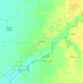
Name: Richland topographic map, elevation, terrain.
Location: Richland, Rush County, Indiana, United States (39.47775 -85.41482 39.51775 -85.37482)
Average elevation: 310 m
Minimum elevation: 297 m
Maximum elevation: 323 m
Thank you for supporting this site ❤️
Make a donation
Make a donation
Other topographic maps
Click on a map to view its topography, its elevation and its terrain.