
El Achour topographic map
Interactive map
Click on the map to display elevation.
About this map
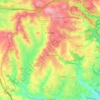
Name: El Achour topographic map, elevation, terrain.
Location: El Achour, Daïra Draria, Alger, Algérie (36.70313 2.96238 36.74931 3.01376)
Average elevation: 198 m
Minimum elevation: 109 m
Maximum elevation: 265 m