
Saint-Félix topographic map
Interactive map
Click on the map to display elevation.
About this map
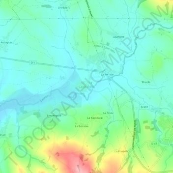
Name: Saint-Félix topographic map, elevation, terrain.
Average elevation: 486 m
Minimum elevation: 449 m
Maximum elevation: 598 m
Other topographic maps
Click on a map to view its topography, its elevation and its terrain.
Pautussac
France > Occitanie > Aveyron > Anglars-Saint-Félix > Saint-Félix > La Remise
Pautussac, La Remise, Saint-Félix, Anglars-Saint-Félix, Villefranche-de-Rouergue, Aveyron, Occitanie, France métropolitaine, 12390, France
Average elevation: 472 m
Anglars
France > Occitanie > Aveyron > Anglars-Saint-Félix
Anglars, Anglars-Saint-Félix, Villefranche-de-Rouergue, Aveyron, Occitanie, France métropolitaine, 12390, France
Average elevation: 482 m