
Meilleurs Bay topographic map
Interactive map
Click on the map to display elevation.
About this map
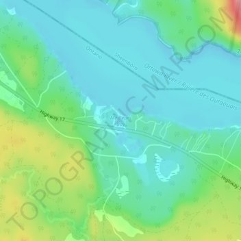
Name: Meilleurs Bay topographic map, elevation, terrain.
Average elevation: 137 m
Minimum elevation: 104 m
Maximum elevation: 229 m
Other topographic maps
Click on a map to view its topography, its elevation and its terrain.
Renfrew
Canada > Ontario > Renfrew County
Renfrew, Renfrew County, Est de l'Ontario, Ontario, Canada
Average elevation: 142 m
Westmeath
Canada > Ontario > Renfrew County > Whitewater Region > Westmeath
Westmeath, Whitewater Region, Renfrew County, Est de l'Ontario, Ontario, K0J 2L0, Canada
Average elevation: 123 m