
Chalo topographic map
Click on the map to display elevation.
About this map
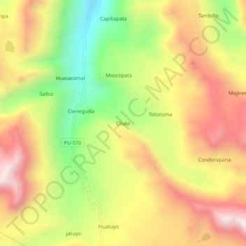
Name: Chalo topographic map, elevation, terrain.
Location: Chalo, Usicayos, Carabaya, Puno, Perú (-14.26026 -69.90956 -14.22026 -69.86956)
Average elevation: 4,515 m
Minimum elevation: 4,080 m
Maximum elevation: 4,907 m