
Thank you for supporting this site ❤️
Make a donation
Make a donation
Moneygall topographic map
Click on the map to display elevation.
Thank you for supporting this site ❤️
Make a donation
Make a donation
About this map
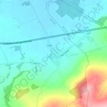
Name: Moneygall topographic map, elevation, terrain.
Location: Moneygall, County Offaly, Leinster, Ireland (52.87633 -7.96264 52.88470 -7.94729)
Average elevation: 146 m
Minimum elevation: 106 m
Maximum elevation: 273 m
Thank you for supporting this site ❤️
Make a donation
Make a donation