
Longarone topographic map
Interactive map
Click on the map to display elevation.
About this map
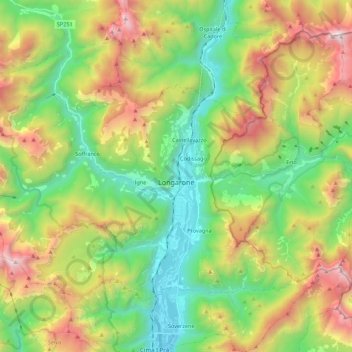
Name: Longarone topographic map, elevation, terrain.
Location: Longarone, BL, Venetien, 32013, Italien (46.21432 12.15205 46.32230 12.37237)
Average elevation: 1,212 m
Minimum elevation: 378 m
Maximum elevation: 2,617 m