
Beuningen Gld topographic map
Interactive map
Click on the map to display elevation.
About this map
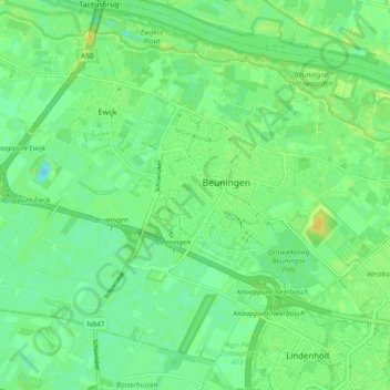
Name: Beuningen Gld topographic map, elevation, terrain.
Location: Beuningen Gld, Beuningen, Gelderland, Nederland (51.83227 5.71763 51.88112 5.81031)
Average elevation: 9 m
Minimum elevation: 0 m
Maximum elevation: 20 m
Other topographic maps
Click on a map to view its topography, its elevation and its terrain.
Ewijk
Nederland > Gelderland > Beuningen
Ewijk, Beuningen, Gelderland, Nederland
Average elevation: 9 m
Weurt
Nederland > Gelderland > Beuningen
Weurt, Beuningen, Gelderland, Nederland
Average elevation: 10 m
Winssen
Nederland > Gelderland > Beuningen
Winssen, Beuningen, Gelderland, Nederland
Average elevation: 9 m