
Thank you for supporting this site ❤️
Make a donation
Make a donation
Stirling Falls topographic map
Click on the map to display elevation.
Thank you for supporting this site ❤️
Make a donation
Make a donation
About this map
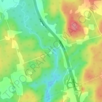
Name: Stirling Falls topographic map, elevation, terrain.
Average elevation: 335 m
Minimum elevation: 297 m
Maximum elevation: 383 m
Thank you for supporting this site ❤️
Make a donation
Make a donation
Other topographic maps
Click on a map to view its topography, its elevation and its terrain.
Lake Bernard
Canada > Ontario > Parry Sound District > Strong Township > Sundridge
Average elevation: 347 m