
Thank you for supporting this site ❤️
Make a donation
Make a donation
Las Khorey topographic map
Click on the map to display elevation.
Thank you for supporting this site ❤️
Make a donation
Make a donation
About this map
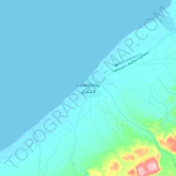
Name: Las Khorey topographic map, elevation, terrain.
Location: Las Khorey, Las Khorey District, Sanaag, Somaliland, Somalia (11.12027 48.15487 11.20027 48.23487)
Average elevation: 18 m
Minimum elevation: -1 m
Maximum elevation: 199 m
Thank you for supporting this site ❤️
Make a donation
Make a donation