
Thank you for supporting this site ❤️
Make a donation
Make a donation
Jülich topographic map
Click on the map to display elevation.
Thank you for supporting this site ❤️
Make a donation
Make a donation
About this map
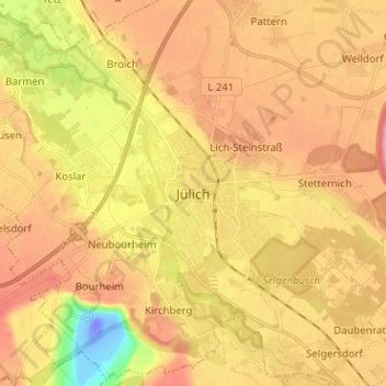
Name: Jülich topographic map, elevation, terrain.
Location: Jülich, Kreis Düren, Noordrijn-Westfalen, 52428, Duitsland (50.88209 6.32110 50.96209 6.40110)
Average elevation: 89 m
Minimum elevation: -50 m
Maximum elevation: 157 m
Thank you for supporting this site ❤️
Make a donation
Make a donation