
Schellebelle topographic map
Interactive map
Click on the map to display elevation.
About this map
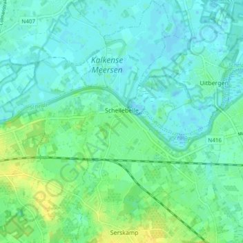
Name: Schellebelle topographic map, elevation, terrain.
Average elevation: 7 m
Minimum elevation: -1 m
Maximum elevation: 26 m
Other topographic maps
Click on a map to view its topography, its elevation and its terrain.
Bruinbeke
België > Oost-Vlaanderen > Dendermonde > Wichelen > Schellebelle
Bruinbeke, Schellebelle, Wichelen, Dendermonde, Oost-Vlaanderen, 9260, België
Average elevation: 10 m
Wichelen
België > Oost-Vlaanderen > Dendermonde > Wichelen
Wichelen, Dendermonde, Oost-Vlaanderen, 9360, België
Average elevation: 7 m
Serskamp
België > Oost-Vlaanderen > Dendermonde > Wichelen
Serskamp, Wichelen, Dendermonde, Oost-Vlaanderen, België
Average elevation: 14 m