
Windlesham topographic map
Click on the map to display elevation.
About this map
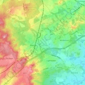
Name: Windlesham topographic map, elevation, terrain.
Average elevation: 77 m
Minimum elevation: 32 m
Maximum elevation: 133 m
Other topographic maps
Click on a map to view its topography, its elevation and its terrain.
Bagshot Park Mansion
United Kingdom > England > Surrey > Surrey Heath > Bagshot
Average elevation: 76 m