
Thank you for supporting this site ❤️
Make a donation
Make a donation
Auburndale topographic map
Click on the map to display elevation.
Thank you for supporting this site ❤️
Make a donation
Make a donation
About this map
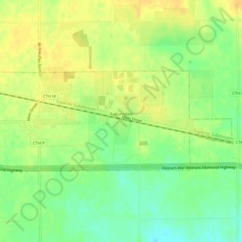
Name: Auburndale topographic map, elevation, terrain.
Location: Auburndale, Wood County, Wisconsin, United States (44.61932 -90.03567 44.63395 -89.98607)
Average elevation: 371 m
Minimum elevation: 354 m
Maximum elevation: 383 m
Thank you for supporting this site ❤️
Make a donation
Make a donation
Other topographic maps
Click on a map to view its topography, its elevation and its terrain.