
Thank you for supporting this site ❤️
Make a donation
Make a donation
Essex Junction topographic map
Click on the map to display elevation.
Thank you for supporting this site ❤️
Make a donation
Make a donation
About this map
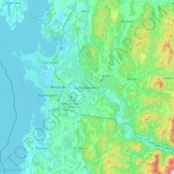
Name: Essex Junction topographic map, elevation, terrain.
Location: Essex Junction, Chittenden County, Vermont, United States (44.33068 -73.27136 44.65068 -72.95136)
Average elevation: 154 m
Minimum elevation: 25 m
Maximum elevation: 917 m
Thank you for supporting this site ❤️
Make a donation
Make a donation
Other topographic maps
Click on a map to view its topography, its elevation and its terrain.