
La Lutrive topographic map
Interactive map
Click on the map to display elevation.
About this map
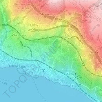
Name: La Lutrive topographic map, elevation, terrain.
Location: La Lutrive, Lutry, District de Lavaux-Oron, Vaud, 1095, Suisse (46.50549 6.68776 46.51091 6.69375)
Average elevation: 500 m
Minimum elevation: 369 m
Maximum elevation: 723 m
Other topographic maps
Click on a map to view its topography, its elevation and its terrain.
Ruisseau de Bossières
Ruisseau de Bossières, Lutry, District de Lavaux-Oron, Vaud, 1095, Suisse
Average elevation: 492 m