
Adaúfe topographic map
Interactive map
Click on the map to display elevation.
About this map
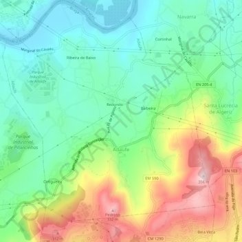
Name: Adaúfe topographic map, elevation, terrain.
Location: Adaúfe, Braga, Cávado, Norte, Portugal (41.56980 -8.42113 41.61012 -8.37374)
Average elevation: 136 m
Minimum elevation: 22 m
Maximum elevation: 345 m