
Patha Cuddapah topographic map
Click on the map to display elevation.
About this map
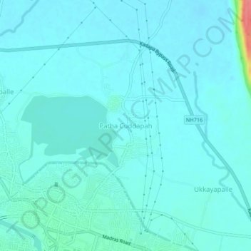
Name: Patha Cuddapah topographic map, elevation, terrain.
Location: Patha Cuddapah, Kadapa, YSR, Andhra Pradesh, 516002, India (14.47566 78.81493 14.51566 78.85493)
Average elevation: 126 m
Minimum elevation: 117 m
Maximum elevation: 188 m