
Étalle topographic map
Interactive map
Click on the map to display elevation.
About this map
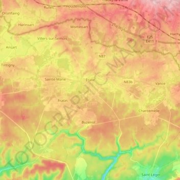
Name: Étalle topographic map, elevation, terrain.
Location: Étalle, Virton, Luxembourg, Wallonie, Belgique (49.62135 5.52562 49.71150 5.69951)
Average elevation: 342 m
Minimum elevation: 244 m
Maximum elevation: 418 m