
Thank you for supporting this site ❤️
Make a donation
Make a donation
Menin topographic map
Click on the map to display elevation.
Thank you for supporting this site ❤️
Make a donation
Make a donation
About this map
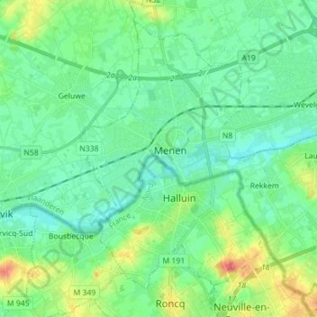
Name: Menin topographic map, elevation, terrain.
Location: Menin, Kortrijk, West Flanders, 8930, Belgium (50.75532 3.08059 50.83219 3.21965)
Average elevation: 25 m
Minimum elevation: 7 m
Maximum elevation: 69 m
Thank you for supporting this site ❤️
Make a donation
Make a donation
Other topographic maps
Click on a map to view its topography, its elevation and its terrain.