
Thank you for supporting this site ❤️
Make a donation
Make a donation
Kesra topographic map
Click on the map to display elevation.
Thank you for supporting this site ❤️
Make a donation
Make a donation
Kesra
Kesra is a town and commune in the Siliana Governorate, Tunisia. As of 2004 it had a population of 2,490. In 2014 this was 2,600. Kesra is in Siliana Governorate near Maktar at 35.8N and 9.36e. The town is at altitude of 966m and is near the Jebel Serj national park. During the Roman Empire Kesra was a civitas of the Roman Province of Byzacena called Cusira.
Thank you for supporting this site ❤️
Make a donation
Make a donation
About this map
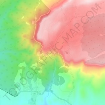
Name: Kesra topographic map, elevation, terrain.
Location: Kesra, كسرى, معتمدية كسرى, Siliana, 6141, Tunisia (35.79316 9.34483 35.83316 9.38483)
Average elevation: 937 m
Minimum elevation: 769 m
Maximum elevation: 1,089 m
Thank you for supporting this site ❤️
Make a donation
Make a donation