
Thank you for supporting this site ❤️
Make a donation
Make a donation
Pontotoc County topographic map
Click on the map to display elevation.
Thank you for supporting this site ❤️
Make a donation
Make a donation
About this map
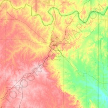
Name: Pontotoc County topographic map, elevation, terrain.
Location: Pontotoc County, Oklahoma, United States (34.50548 -96.93251 34.96582 -96.40611)
Average elevation: 292 m
Minimum elevation: 186 m
Maximum elevation: 407 m
Thank you for supporting this site ❤️
Make a donation
Make a donation