
Thank you for supporting this site ❤️
Make a donation
Make a donation
Nimruz Province topographic map
Click on the map to display elevation.
Thank you for supporting this site ❤️
Make a donation
Make a donation
About this map
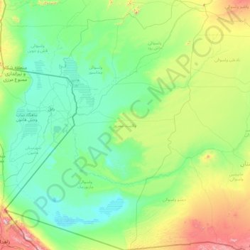
Name: Nimruz Province topographic map, elevation, terrain.
Location: Nimruz Province, Afghanistan (29.38959 60.87286 32.25679 63.58947)
Average elevation: 696 m
Minimum elevation: 452 m
Maximum elevation: 2,273 m
Thank you for supporting this site ❤️
Make a donation
Make a donation
Other topographic maps
Click on a map to view its topography, its elevation and its terrain.