
Thank you for supporting this site ❤️
Make a donation
Make a donation
Bateh Sariak topographic map
Click on the map to display elevation.
Thank you for supporting this site ❤️
Make a donation
Make a donation
About this map
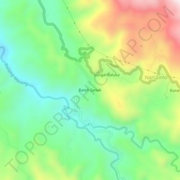
Name: Bateh Sariak topographic map, elevation, terrain.
Location: Bateh Sariak, Agam, West Sumatra, Sumatra, 26151, Indonesia (-0.16035 100.22014 -0.12035 100.26014)
Average elevation: 550 m
Minimum elevation: 295 m
Maximum elevation: 982 m
Thank you for supporting this site ❤️
Make a donation
Make a donation