
Pilon Island topographic map
Interactive map
Click on the map to display elevation.
About this map
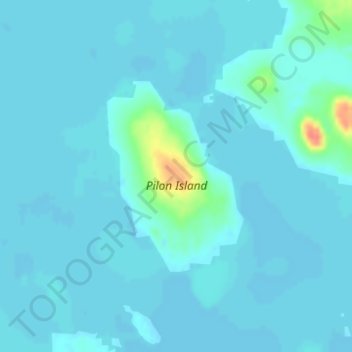
Name: Pilon Island topographic map, elevation, terrain.
Location: Pilon Island, Región de Kivalliq, Nunavut, Canadá (64.05965 -94.36789 64.07432 -94.34380)
Average elevation: 5 m
Minimum elevation: 1 m
Maximum elevation: 48 m