
Thank you for supporting this site ❤️
Make a donation
Make a donation
Monticello Township topographic map
Click on the map to display elevation.
Thank you for supporting this site ❤️
Make a donation
Make a donation
About this map
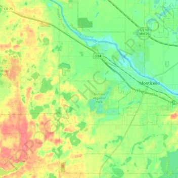
Name: Monticello Township topographic map, elevation, terrain.
Location: Monticello Township, Wright County, Minnesota, United States (45.23757 -93.89087 45.36436 -93.70101)
Average elevation: 297 m
Minimum elevation: 272 m
Maximum elevation: 333 m
Thank you for supporting this site ❤️
Make a donation
Make a donation
Other topographic maps
Click on a map to view its topography, its elevation and its terrain.
South Haven
United States > Minnesota > Wright County > South Haven > South Haven
Average elevation: 331 m
Thank you for supporting this site ❤️
Make a donation
Make a donation
Maple Lake
United States > Minnesota > Wright County > Maple Lake > Maple Lake
Average elevation: 314 m