
Piastowo topographic map
Interactive map
Click on the map to display elevation.
About this map
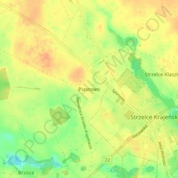
Name: Piastowo topographic map, elevation, terrain.
Average elevation: 77 m
Minimum elevation: 55 m
Maximum elevation: 91 m
Other topographic maps
Click on a map to view its topography, its elevation and its terrain.
Stare Osieczno
Poland > Lubusz Voivodeship > Strzelce-Drezdenko County
Stare Osieczno, gmina Dobiegniew, Strzelce-Drezdenko County, Lubusz Voivodeship, 66-522, Poland
Average elevation: 60 m