
Thank you for supporting this site ❤️
Make a donation
Make a donation
Creekmur Hill topographic map
Click on the map to display elevation.
Thank you for supporting this site ❤️
Make a donation
Make a donation
About this map
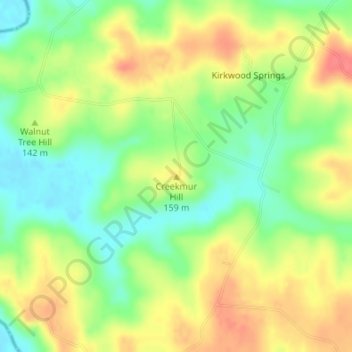
Name: Creekmur Hill topographic map, elevation, terrain.
Location: Creekmur Hill, Hopkins County, Kentucky, United States (37.24333 -87.77173 37.24343 -87.77163)
Average elevation: 139 m
Minimum elevation: 109 m
Maximum elevation: 171 m
Thank you for supporting this site ❤️
Make a donation
Make a donation
Other topographic maps
Click on a map to view its topography, its elevation and its terrain.