
Weimar (Lahn) topographic map
Click on the map to display elevation.
About this map
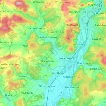
Name: Weimar (Lahn) topographic map, elevation, terrain.
Average elevation: 236 m
Minimum elevation: 163 m
Maximum elevation: 392 m
Other topographic maps
Click on a map to view its topography, its elevation and its terrain.
Aurorahütte
Germany > Hesse > Landkreis Marburg-Biedenkopf > Gladenbach > Erdhausen
Average elevation: 298 m