
Dharali topographic map
Click on the map to display elevation.
About this map
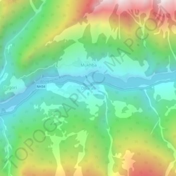
Name: Dharali topographic map, elevation, terrain.
Location: Dharali, Bhatwari, Uttarkashi, Uttarakhand, India (31.02085 78.76153 31.06085 78.80153)
Average elevation: 2,977 m
Minimum elevation: 2,491 m
Maximum elevation: 3,964 m
Other topographic maps
Click on a map to view its topography, its elevation and its terrain.