Geolocate

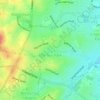
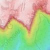
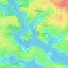
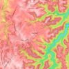
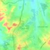
Manly Dam topographic map

Click on the map to display elevation.

About this map

Name: Manly Dam topographic map, elevation, terrain.

Location: Manly Dam, Manly Hydraulics Laboratory, Allambie Heights, Northern Beaches, Sydney, Northern Beaches Council, New South Wales, 2100, Australia (-33.78240 151.25557 -33.78045 151.25575)

Average elevation: 51 m

Minimum elevation: 0 m

Maximum elevation: 123 m

Other topographic maps

Click on a map to view its topography, its elevation and its terrain.
Penrith

Australia > New South Wales > Sydney > Penrith

Penrith is a city in New South Wales, Australia, located in Greater Western Sydney, 55 kilometres (31 mi) west of the Sydney central business district on the banks of the Nepean River, on the outskirts of the Cumberland Plain. Its elevation is 32 metres (105 ft).

Average elevation: 34 m
Northern Beaches

Australia > New South Wales > Sydney

Average elevation: 67 m

Edensor Park

Australia > New South Wales > Sydney

Average elevation: 57 m

Camellia

Australia > New South Wales > Sydney

Average elevation: 11 m

Ingleside

Australia > New South Wales > Sydney

Average elevation: 89 m

Darlinghurst

Australia > New South Wales > Sydney

Average elevation: 38 m

Annandale

Australia > New South Wales > Sydney

Average elevation: 24 m

North Sydney

Australia > New South Wales > Sydney

Average elevation: 50 m

Sydney

Australia > New South Wales > Sydney

Average elevation: 23 m

Lower North Shore

Australia > New South Wales > Sydney

Average elevation: 45 m

Scheyville

Australia > New South Wales > Sydney

Average elevation: 38 m

Mosman

Australia > New South Wales > Sydney

Average elevation: 29 m

Schofields

Australia > New South Wales > Sydney

Average elevation: 32 m

Leichhardt

Australia > New South Wales > Sydney

Average elevation: 22 m

Bankstown

Australia > New South Wales > Sydney

Average elevation: 34 m
Marrickville

Australia > New South Wales > Sydney

Average elevation: 17 m

Blacktown

Australia > New South Wales > Sydney

Average elevation: 57 m

Clovelly

Australia > New South Wales > Sydney

Average elevation: 32 m

Killarney Heights

Australia > New South Wales > Sydney

Average elevation: 72 m

Randwick

Australia > New South Wales > Sydney

Average elevation: 44 m

Mount Druitt

Australia > New South Wales > Sydney

Average elevation: 52 m

Turramurra

Australia > New South Wales > Sydney

Average elevation: 143 m

Dee Why

Australia > New South Wales > Sydney

Average elevation: 31 m

Rose Bay

Australia > New South Wales > Sydney

Average elevation: 31 m

Bondi Beach

Australia > New South Wales > Sydney

Average elevation: 31 m

Hills District

Australia > New South Wales > Sydney

Average elevation: 91 m

Eastern Suburbs

Australia > New South Wales > Sydney

Average elevation: 12 m

Woronora

Australia > New South Wales > Sydney

Woronora Plateau, is a geographical region adjacent to the Sydney Plain. Slightly higher in altitude, it is capped with Hawkesbury Sandstone. The Woronora River flows through the deeply dissected plateau to the Georges River from near the sources of the Port Hacking, within the Sutherland Shire.

Average elevation: 65 m

Darling Point

Australia > New South Wales > Sydney

Average elevation: 23 m

North Head

Australia > New South Wales > Sydney

Average elevation: 22 m

St Ives

Australia > New South Wales > Sydney

Average elevation: 125 m

Epping

Australia > New South Wales > Sydney

Average elevation: 96 m

Wentworth Falls

Australia > New South Wales > Sydney

Wentworth Falls (postcode: 2782) is a town in the Blue Mountains region of New South Wales, situated approximately 100 kilometres (62 mi) west of the Sydney central business district, and about 8 kilometres (5.0 mi) east of Katoomba, Australia on the Great Western Highway, with a Wentworth Falls railway…

Average elevation: 708 m

Scotland Island

Australia > New South Wales > Sydney

Average elevation: 17 m

Carlingford

Australia > New South Wales > Sydney

Average elevation: 98 m

Marsfield

Australia > New South Wales > Sydney

Average elevation: 72 m

Baulkham Hills

Australia > New South Wales > Sydney

Average elevation: 93 m

Eastwood

Australia > New South Wales > Sydney

Average elevation: 80 m

North Ryde

Australia > New South Wales > Sydney

Average elevation: 52 m

Botany Bay

Australia > New South Wales > Sydney

Average elevation: 8 m

Kurnell

Australia > New South Wales > Sydney

Average elevation: 4 m

Terrey Hills

Australia > New South Wales > Sydney

Owing to its elevation and close proximity to the ocean, as well as its extensive tree canopy cover, the weather station at Terrey Hills records the mildest temperatures of any weather station in the Greater Sydney region. Under Köppen's scheme, the suburb has a borderline humid subtropical (Cfa) and oceanic…

Average elevation: 146 m

Ashfield

Australia > New South Wales > Sydney

Average elevation: 26 m

Roseville

Australia > New South Wales > Sydney

Average elevation: 84 m

Camperdown

Australia > New South Wales > Sydney

Average elevation: 26 m

Engadine

Australia > New South Wales > Sydney

Average elevation: 121 m

Bellevue Hill

Australia > New South Wales > Sydney

Average elevation: 36 m

Balgowlah Heights

Australia > New South Wales > Sydney

Average elevation: 25 m

Centennial Park

Australia > New South Wales > Sydney

Average elevation: 51 m

Zetland

Australia > New South Wales > Sydney

Average elevation: 26 m

Hornsby

Australia > New South Wales > Sydney

Average elevation: 160 m

Thornleigh

Australia > New South Wales > Sydney

Thornleigh is bounded to the north by Waitara Creek and south by the Lane Cove National Park. Thornleigh borders the suburbs of Normanhurst, Hornsby, Wahroonga, Westleigh and Pennant Hills. Thornleigh offers great district views, and the topography varies greatly with many established areas built around…

Average elevation: 159 m

Bilgola Beach

Australia > New South Wales > Sydney

Average elevation: 35 m

Lane Cove National Park

Australia > New South Wales > Sydney

The park includes areas of land which are part of Ku-ring-gai, Ryde, and Hornsby local government areas with small areas of the park in Willoughby, Lane Cove and Hunter's Hill local government areas on the banks of the lower reaches of the river. The park is surrounded on all sides by developed suburban areas…

Average elevation: 81 m

Ryde

Australia > New South Wales > Sydney

Average elevation: 52 m

Echo Point

Australia > New South Wales > Sydney

Average elevation: 725 m

Bennelong Point

Australia > New South Wales > Sydney

Average elevation: 13 m

Darling Harbour

Australia > New South Wales > Sydney

Average elevation: 23 m

Clontarf

Australia > New South Wales > Sydney

Average elevation: 35 m

Burns Bay

Australia > New South Wales > Sydney

Average elevation: 27 m

Oakhurst

Australia > New South Wales > Sydney

Average elevation: 49 m

Middle Head

Australia > New South Wales > Sydney

Average elevation: 9 m

Newport

Australia > New South Wales > Sydney

Average elevation: 27 m

Enmore

Australia > New South Wales > Sydney

Average elevation: 23 m

Mort's Bay

Australia > New South Wales > Sydney

Average elevation: 10 m

Cremorne Point

Australia > New South Wales > Sydney

Average elevation: 29 m

Whipbird Gully

Australia > New South Wales > Sydney

Average elevation: 111 m

Lucas Heights

Australia > New South Wales > Sydney

Due to its elevation, Lucas Heights is one of the few places in Sydney that has a borderline Oceanic (Cfb) and a Humid subtropical climate (Cfa).

Average elevation: 115 m

Inner West Council

Australia > New South Wales > Sydney

Average elevation: 19 m

Sylvania

Australia > New South Wales > Sydney

Average elevation: 19 m

Woodford

Australia > New South Wales > Sydney

Woodford is a village in the Blue Mountains in New South Wales, Australia, about 90 kilometres west of Sydney. Its elevation is 609 metres (1,998 ft) above sea level. It is situated on the Great Western Highway and has a railway station (opened in 1868 as Buss's Platform) on the Main Western railway line…

Average elevation: 544 m
Hurstville

Australia > New South Wales > Sydney

Average elevation: 50 m

Rockdale

Australia > New South Wales > Sydney

Average elevation: 20 m

Bella Vista

Australia > New South Wales > Sydney

Average elevation: 79 m

Waverton

Australia > New South Wales > Sydney

Average elevation: 33 m

Berkshire Park

Australia > New South Wales > Sydney

Average elevation: 27 m

St Leonards

Australia > New South Wales > Sydney

Average elevation: 69 m

Denistone West

Australia > New South Wales > Sydney

Average elevation: 55 m

Parsley Bay

Australia > New South Wales > Sydney > Brooklyn

Average elevation: 20 m

Nelson

Australia > New South Wales > Sydney

Average elevation: 47 m

Beaconsfield

Australia > New South Wales > Sydney

Average elevation: 18 m

Peak Hill

Australia > New South Wales > Sydney

Average elevation: 58 m

Smithfield

Australia > New South Wales > Sydney

Established in 1836, Smithfield was the first major settlement of the Fairfield LGA. The original 1838 summary plan of Smithfield shows the suburb laid out in a grid pattern with most of the streets having the same names as they do today. Its altitude ranges from 21 to 48 m (69 to 157 ft) above sea level.…

Average elevation: 33 m
Cronulla Point

Australia > New South Wales > Sydney

Average elevation: 7 m

Holroyd

Australia > New South Wales > Sydney

Average elevation: 24 m

Richmond Lowlands

Australia > New South Wales > Sydney

Average elevation: 13 m

Oyster Bay

Australia > New South Wales > Sydney

Average elevation: 25 m

North Curl Curl

Australia > New South Wales > Sydney

Average elevation: 22 m

Macquarie Park

Australia > New South Wales > Sydney

Average elevation: 59 m

Sans Souci

Australia > New South Wales > Sydney

Average elevation: 4 m

Galston

Australia > New South Wales > Sydney

Average elevation: 167 m

Gregory Hills

Australia > New South Wales > Sydney

Gregory Hills is a suburb of Sydney in the state of New South Wales, Australia in Camden Council. The suburb was assigned on 1 August 2008. The suburb was named from the topography of the local area and from the original St Gregory's Chapel on the Marist Brothers land.

Average elevation: 109 m
Oran Park

Australia > New South Wales > Sydney

Average elevation: 93 m

Moorebank

Australia > New South Wales > Sydney

Average elevation: 12 m

Killara

Australia > New South Wales > Sydney

Average elevation: 86 m