
Fort Worth topographic map
Interactive map
Click on the map to display elevation.
About this map
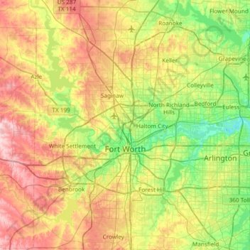
Name: Fort Worth topographic map, elevation, terrain.
Location: Fort Worth, Tarrant County, Texas, États-Unis d'Amérique (32.55158 -97.59239 33.04953 -97.03358)
Average elevation: 212 m
Minimum elevation: 133 m
Maximum elevation: 333 m