
Thank you for supporting this site ❤️
Make a donation
Make a donation
Pine Lodge topographic map
Click on the map to display elevation.
Thank you for supporting this site ❤️
Make a donation
Make a donation
About this map
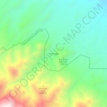
Name: Pine Lodge topographic map, elevation, terrain.
Location: Pine Lodge, Lincoln County, New Mexico, United States (33.60314 -105.26499 33.64314 -105.22499)
Average elevation: 2,021 m
Minimum elevation: 1,718 m
Maximum elevation: 2,646 m
Thank you for supporting this site ❤️
Make a donation
Make a donation