
Torata topographic map
Click on the map to display elevation.
About this map
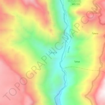
Name: Torata topographic map, elevation, terrain.
Location: Torata, General Sánchez Cerro, Moquegua, Perú (-16.37102 -70.76346 -16.33102 -70.72346)
Average elevation: 3,621 m
Minimum elevation: 3,070 m
Maximum elevation: 4,159 m
Other topographic maps
Click on a map to view its topography, its elevation and its terrain.