
Thank you for supporting this site ❤️
Make a donation
Make a donation
Yayla topographic map
Click on the map to display elevation.
Thank you for supporting this site ❤️
Make a donation
Make a donation
About this map
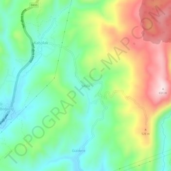
Name: Yayla topographic map, elevation, terrain.
Location: Yayla, Düzce, Black Sea Region, 81620, Turkey (40.93103 31.17044 40.97103 31.21044)
Average elevation: 383 m
Minimum elevation: 227 m
Maximum elevation: 652 m
Thank you for supporting this site ❤️
Make a donation
Make a donation
Other topographic maps
Click on a map to view its topography, its elevation and its terrain.