

Heidenburg topographic map
Click on the map to display elevation.
Heidenburg
The municipality lies in the Hunsrück south of the bow in the Moselle between Leiwen and Trittenheim. Between Heidenburg and the Moselle is the valley of the Kleine Dhron, a deep cut in the landscape. Not far downstream, the Kleine Dhron feeds the Dhron reservoir. An outstanding scenic view is to be had from the heights around Heidenburg: the Moselle valley from Klüsserath through Leiwen and Trittenheim to Neumagen-Dhron; the mountains of the Eifel and the Erbeskopf – the highest elevation in Rhineland-Palatinate – the Dhron reservoir and through the tree cover, Dhrönchen, the writer Stefan Andres’s birthplace. As well as the views into the distance, the municipality offers a wealth of plant life and wildlife in its meadows and forests.
About this map

Name: Heidenburg topographic map, elevation, terrain.
Average elevation: 349 m
Minimum elevation: 114 m
Maximum elevation: 475 m
Other topographic maps
Click on a map to view its topography, its elevation and its terrain.
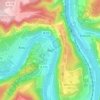
Wolf
Germany > Rhineland-Palatinate > Landkreis Bernkastel-Wittlich > Traben-Trarbach
Average elevation: 201 m
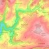
Weiperath
Germany > Rhineland-Palatinate > Landkreis Bernkastel-Wittlich > Morbach
The municipality lies at an elevation of between 430 and 770 m above sea level in the low mountain range of the Hunsrück on the boundary with the Birkenfeld district, roughly 25 km southeast of Wittlich and 35 km east of Trier. Its population is 11,051. The nearest town is Bernkastel-Kues.
Average elevation: 439 m
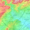
Wittlich
Germany > Rhineland-Palatinate > Landkreis Bernkastel-Wittlich > Wittlich
Average elevation: 237 m